
Twelve Capital Event Update
3 July 2023Hurricane Situation
Over the previous two weeks two storms were registered; Bret which formed of the west coast of Africa before heading through the Lesser Antilles as a tropical storm, and Cindy which formed directly behind Bret, and moved northeast into open waters and has not currently made landfall. As of today, neither event is expected to have an impact to any positions.
There are currently no systems in the Atlantic, nor any forecasted for the coming seven days.
An Active Start to the Season
One month into the Atlantic hurricane season and we have already seen three named storms, which ties the record for most active number of storms in June since records began, albeit none of which have caused significant insured losses.
A key contributor to the active start to the season is warm sea surface temperatures in the Atlantic, specifically in the main development region (MDR) where a large number of storms form. However, El Niño conditions are present and are expected to strengthen in the coming months, which tends to inhibit storm formation in the Atlantic. One factor in particular is increased wind shear, which appears to have been a key factor in the weakening of both Tropical Storm Bret and Cindy.
The chart below shows how observed hurricane activity (measured by Accumulated Cyclone Energy; ACE) from the current season compares to the average ACE (1991-2020) one month in. It also illustrates that the peak of the hurricane season is still ahead of us, so we will continue to monitor sea surface temperatures and the El Niño conditions through the coming months.
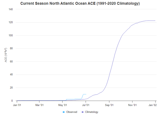
Source: http://tropical.atmos.colostate.edu/Realtime/index.php?loc=northatlantic
Twelve Capital continues to closely monitor relevant potential and actual catastrophe events and will issue specific updates on new major events which will occur.